The Broward Metropolitan Planning Organization (MPO) and its partners are integrating climate change adaptation goals into the transportation decision making process and looking to minimize the impacts of extreme weather events and sea level rise on the regional transportation network.
Important Links
- South Florida Climate Change Vulnerability and Adaptation Pilot Project Final Report (April 2015)
- Vulnerability Appendix
- Appendix A - Regional Ranking
- Appendix B - Jurisdiction Ranking
- Appendix C- Sea Level Rise Scenario Ranking
- Broward County Climate Action Plan: Local Strategy to Address Global Climate Change- Approved Jan. 2016
- Extreme Weather and Climate Change Risk to the Transportation System in Broward County, Florida, September 2016, Final Report- Draft
First Phase
The Broward MPO administered the South Florida Climate Change Vulnerability and Adaptation Pilot Project.
The Pilot Project covers the four counties and three MPOs in the South Florida area. The purpose of the Pilot Project is to determine the impact of extreme weather on the area's regional transportation network based on the following stressors: sea level rise, storm surge, and precipitation induced flooding. The focus of the Pilot Project is to develop a consistent methodology for integrating vulnerability into the MPO transportation decision making process. A second phase to this project will apply the climate change stressors to county and local roadways within the Broward region. The analysis will result in the identification of vulnerable facilities and methods for treatment of the roadways in areas that might be impacted by these stressors. Planning level cost estimates for these treatments and recommended strategic approaches to help the decision-makers determine where transportation investments make sense will also be provided in the second phase. The South Florida Climate Change Vulnerability and Adaptation Pilot Project results was endorsed by the MPO Board on March 12, 2015 and approved by Federal Highway Administration on September 29, 2015.
Second Phase
On December 11, 2014, the Broward MPO authorized the funding of the second phase of the South Florida Climate Change Vulnerability Assessment and Adaption Pilot Project. The second phase, known as the Extreme Weather and Climate Change Risk to the Transportation System in Broward County, Florida Study, addressed the Broward Region’s local/county level needs, building upon the work of the initial Pilot Project. The analysis resulted in the identification of vulnerable facilities and methods for treatment of the roadways in areas that might be impacted by sea level rise, storm surge, and precipitation induced flooding stressors. This second phase project applied the climate change stressors to county and local roadways classified as collectors and above within the Broward region. This effort included an assessment of the locations and elevations of significant roadways and bridges throughout Broward as compared to current and future flood levels. The future flood levels include sea level rise values as identified and agreed upon by the Southeast Florida Climate Change Compact. This study has helped to provide an overview of the risks to the transportation system and should help guide policies and investments to ensure that any decisions made today consider those future risks. This phase was approved by the MPO board on October 13, 2016.
Broward County Climate, Energy, and Sustainability Program Webpage
To view the Broward County Climate, Energy, and Sustainability Program webpage, please visit: http://Broward.org/climate
Archived Documents
- Sea Level Rise Impacts on Florida's Transportation Systems- Full Report
- Broward County Energy and Sustainability Program Presentation May 2011
- Broward MPO Regional Climate Leadership Presentation October 2009
- Broward County Climate Change Action Plan; Addressing Our Changing Climate
- Broward County's Pollution Prevention, Remediation and Air Quality Division (PPRAQD) calculated Broward's carbon footprint for 2007
The Broward MPO hosted All-Hazards Recovery Training, an FTA-sponsored program, on March 5-6, 2018.
9 AICP Credits available.
The purpose of this training was to equip the region to develop a comprehensive emergency recovery plan that maximizes the use of transit, social media, TDM strategies, and ITS technologies.
All-Hazards Recovery Training Agenda
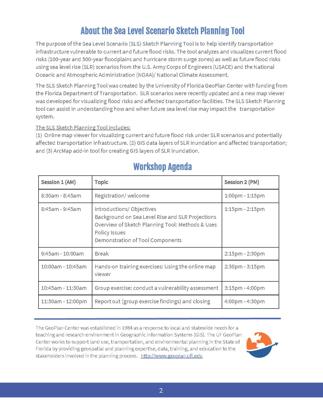
The Broward MPO hosted a Sea Level Rise (SLR) Viewer Training on October 27, 2017.
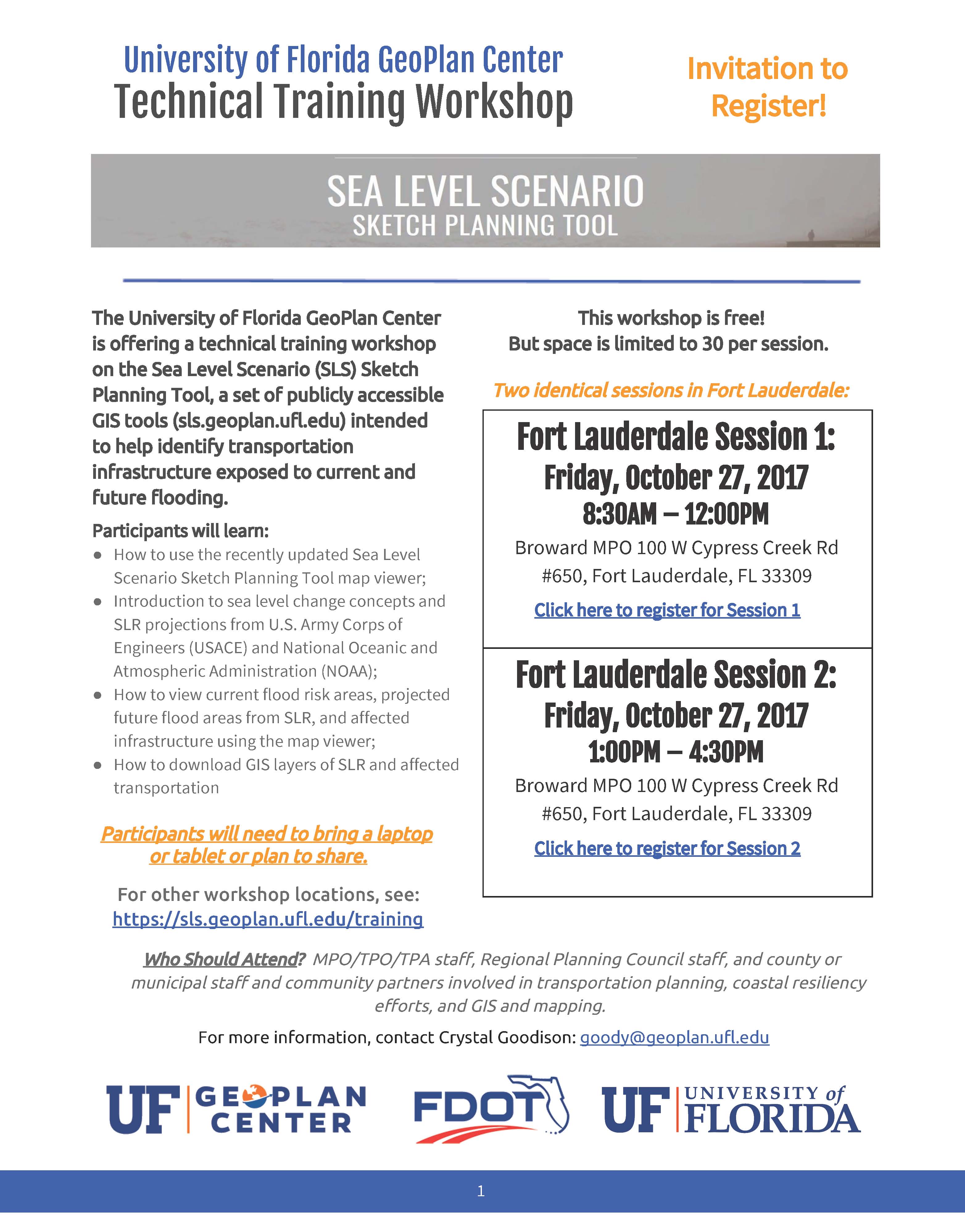
The Broward MPO hosted a Sea Level Scenario Sketch Planning Tool technical training workshop provided by the University of Florida GeoPlan Center on October 27, 2017. This free workshop taught view current flood risk areas, projected future flood risk areas and use GIS tools to identify transportation infrastructure that is exposed to those risks. This training was intended for MPO/TPO/TPA staff, Regional Planning Council staff, local government staff and community partners involved in transportation planning and coastal resiliency.
The Florida Department of Transportation (FDOT) sponsored the training, including information on SLR projections, as well as demonstrations of the tool, guided training exercises, and a group exercise. Target audience for this training: MPO staff, Regional Planning Council staff, and county and municipal transportation and public works staff involved in planning policy, resiliency efforts, and GIS.
The workshop will have a morning and afternoon session with identical content to allow more people to attend. Each session will be limited to 30 people. Each attendee will need to bring a laptop or tablet to their session.
Between the two sessions there will be an optional lunch presentation by Broward County Environmental Planning and Community Resiliency Division about their updated groundwater elevation map that shows future wet season conditions including sea level rise.
To register for a SLR University of Florida GeoPlan Center Technical Training Workshop, CLICK HERE.
The same workshop was held at the St. Lucie TPO on October 31. Below is the information for that workshop.
Port St. Lucie
Tues, October 31, 9:00 a.m. – 2:00 p.m.
St. Lucie TPO
466 SW Port St Lucie Boulevard, Suite 111
Port St Lucie, FL 34953
For more information on either workshop, contact Crystal Goodison: goody@geoplan.ufl.edu

For More Information
Please contact Buffy Sanders II at sandersb@browardmpo.org or (954) 876-0046 to learn more about the Broward MPO and what they are working on in your community.

